Maps of Italy
|
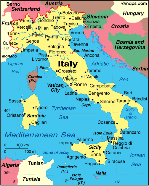
Italy is one of the best-loved tourist destinations the world over. The culture, language, heritage, beauty and food of Italy are credited with this incredible allure. The MapsofWorld Map of Italy combines the best-known tourist attractions of the country, the major cities, the road network, the important airports, the national parks, mountain peaks, lakes, ports and international boundaries of Italy. Major cities plotted on the map include Sicily, Naples, Venice, Rome, Milan, Bologna, Siena, Verona and Florence. The most popular attractions of Italy are Blue Grotto, Via Cola di Rienzo, theColosseum, St Peter's Basilica, Piazza Spagna, the Leaning Tower of Pisa, Lake Garda, and the Dolomites. Apart from the numerous lakes that dot the country, there are many national parks in Italy such as the Alta Murgia National Park, the Gargano National Park and the Abruzzo National Park. Mont Blanc, Courmayeur, at 15771 feet, is the highest peak in the country. Other important peaks are Mt Etna, Punta La Marmora, Ortles, Gran Paradiso and Matterhorn.
Bibliography http://www.mapsofworld.com/italy/ (accessed on 27th may 2015) |
